LAMINAIRES SEPT-ILES
 |
Mapping the kelp distribution area in the Sept-Iles National Nature Reserve using hydroacoustics |
|
Research
Context and Issues
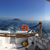
The Sept-Iles National Nature Reserve (northern Brittany) is one of the first protected nature areas in France. Classified as a National Nature Reserve in 1976 (280 ha area) and a Natura 2000 area in 2002, the Reserve shelters the most abundant marine bird colony in metropolitan France, one of the two major French colonies of grey seals and typical vegetation of Atlantic island ecosystems, with 4 protected habitats. Among these, the substantial kelp forests of the Reserve seabed are the main producer of organic matter for the marine ecosystems, and are a relevant shelter, nursery or feeding area for numerous local species. From 2005 to 2007, and again in 2018, the Reserve performed hydroacoustics, an innovative method which is not highly influenced by turbid water, to evaluate changes in the forest and its biomass in the context of global changes and local anthropogenic pressures.Objectives
Analysis of the two surveys validated the feasibility of describing kelp forests using hydroacoustic methods and consequently produced maps of this protected habitat in the Reserve. Kelp forests are also present in areas adjacent to the Sept-Iles Reserve. Extending the covered area aims to improve the knowledge on kelp distribution based on environmental conditions. Creating maps enables measuring their health conditions in the context of global changes and strong anthropogenic pressures.Methodology
Based on the properties of sound dispersal in water, hydroacoustic methods enable, during vertical and mobile acquisitions, recording useful information throughout the study area that cannot be easily measured with other methods, including water depth and the presence of kelp on the seabed. The boat covers the area in transversal transects with a non-overlapping fine resolution. The analysis of geo-referenced data in post-processing identifies the kelp and determines the forest boundaries. Readjusted to the hydrographic zero, the recorded water depths identify the extinction limit of kelp. The 2019 survey is combined with a photographic survey of certain areas conducted by the National Museum of Natural History of Concarneau (CESCO lab).Expected Results
Beyond producing an accurate map of kelp forests in the study area, the study identifies the extinction limits of these algal species and establishes the state of health of this important habitat in the context of the restrictions they encounter. Combining hydroacoustics with photographic analysis will relate the acoustic intensities backscattered by the kelp to a proxy of their density, with the objective of using hydroacoustic data to estimate kelp biomass.Publications issued from the project
MARTIGNAC, F. (2019) .Les cameras acoustiques, ces outils innovants qui permettent d?estimer efficacement la taille des poissons a partir de mesures repetees
MARTIGNAC, F. (2018) .Cartographie des forets de laminaires de la Reserve Naturelle Nationale des Sept-Iles : acquisitions hydroacoustiques et analyse des donnees
MARTIGNAC, F. PROVOST, P. NEVOUX, M. (2018) .Mapping the kelp distribution area of the Sept-Iles national nature reserve (Brittany, France) using hydroacoustics
People involved
 |
MARTIGNAC François, Scientist Phone : +33 2 23 48 56 25 Email : francois.martignac@inrae.fr |